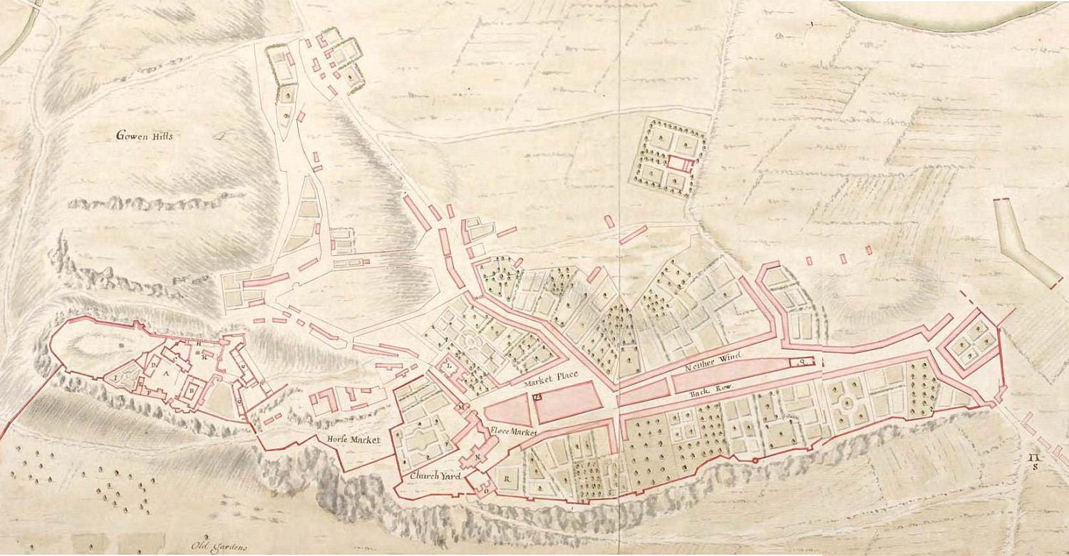
Stirling, 1725 The earliest detailed town plan of Stirling was a military one, drawn in pen and watercolour by the board of ordnance engineer John Laye in 1725. It allows us to see the town with a military eye, picking out many details of the castle fortifications and surrounding topography. From the time of the Treaty of Union in 1707, the British board of ordnance were granted responsibility for Scottish castles and forts, many of which were extremely vulnerable to attack by Jacobite forces. The map picks out the new artillery defences constructed around the entrance to Stirling castle between 1708 and 1714 (G on the map), and allows the castle’s defences and risks of attack from the direction of the town to be clearly assessed
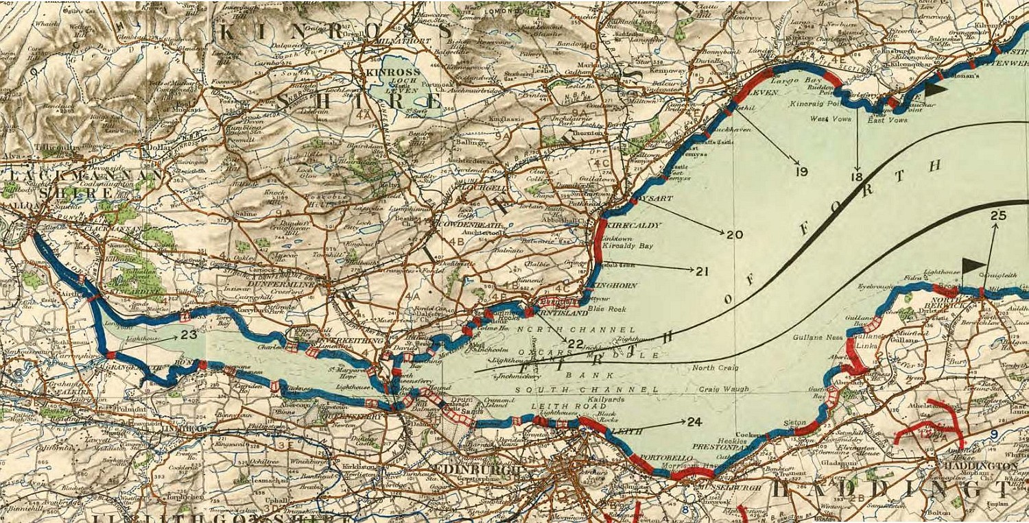
The Forth estuary, 1907 This map by the British war office colour-codes the Forth coastline in terms of its susceptibility for enemy landing – solid red (practicable); red hatched (partly practicable); and blue (impracticable). It accompanied a detailed report on the vulnerability of Edwardian Britain to a seaborne invasion by the Germans
There are few documentary sources as immediate, captivating, and rich as maps in providing insights into history. At a simple level they offer us a basic graphic impression of a place at a point in time, but they can be interpreted at many deeper levels too. Once we question who made the map, what their purpose was, what they included and excluded and who they produced the map for, the map can come alive, often revealing far more than its makers intended.