HOW DOES GOOGLE EARTH WORK?
The app that puts the world in the hands of anyone with a smartphone or computer
WORDS MARK DAVIS
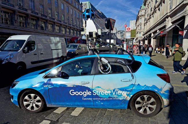
When a user selects ‘Street View’, they are taken down to street level and shown images taken by a special road vehicle with a 360-deg ree camera
© Alamy / Getty / Illustration by The Art Agency; Nick Sellers
Google Earth is a unique geo-mapping and tagging program that uses composite imagery to form a comprehensive, interactive map of Earth. By stitching together more than a billion satellite and aerial images, the application provides a versatile tool that allows individuals and groups to track climate change, discover unknown geographic and ecological features and record history. This digital cartography tool continues to be a useful resource for governments, private organisations and individuals who want to track and tag geographic data to a myriad of ends.