OFF-ROAD NAVIGATION MADE EASY
OnX Offroad Brings Off-Road Trail Maps into the 21st Century
TEXT BY BRYON DORR
IMAGES BY BRYON DORR & ONX OFFROAD
OnX is a Montana-based company best known for their extremely detailed and accurate hunting map app. Hunters have used the onX Hunt app, which has over 4 million active users, for the past 10 years to stay compliant with local laws, navigate to and from remote hunting grounds, and share the thrill of the hunt with friends.
The robust features and clean user interface of the hunting app lead developers to realize that it would be perfectly suited, with some tweaks, for the ever-growing off-road market. OnX Offroad was born as a full-featured off-road navigation app that goes head to head with established off-road nav/trip planning apps like Gaia, FunTreks, and Burns Offroad.
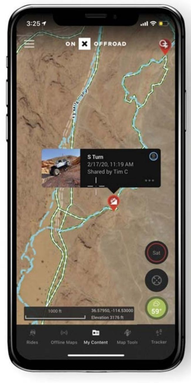
Map detail and tons of useful information easily displayed within one map layer makes onX Offroad super easy to use.
“THE KEY WITH ANY TRULY USEFUL OFF-ROAD TRIP PLANNING AND NAVIGATION SOFTWARE IS THE ABILITY TO USE THE MAPS EVEN WHEN YOU’RE OUT OF RANGE OF CELL TOWERS.”
ONX OFFROAD
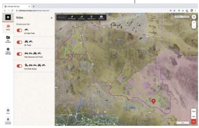
With 350,000-plus miles of trails, 985-plus million acres of public land, 450,000-plus points of interest (POI), and 54,000-plus campgrounds and cabins, onX Offroad is an extremely powerful app for your adventure planning and navigation needs. With trail and road information being updated daily through linked databases and crowdsourced information, it’s easy to stay on top of the latest travel information. In fact, onX’s dedicated in-house GIS team, who are all passionate off-road adventurers, is averaging the addition of 1,000-plus miles of trail per week.