ELEVATION MODEL: JAPAN AEROSPACE EXPLORATION AGENCY (JAXA), 2024. BUILDING FOOTPRINT DATA: OPENSTREETMAP CONTRIBUTORS, 2024. MVSMMP MAPS AVAILABLE AT
BOREALISDATA.CA/DATAVERSE/MVSMMP. MVSMMP MAPS IN THIS ARTICLE: 13 (
DOI.ORG/10.5683/SP3/X23A5D); MAP 15 (
DOI.ORG/10.5683/SP3/WA6MER); 22 (
DOI.ORG/10.5683/SP3/ZIPEZX); 26 (
DOI.ORG/10.5683/SP3/ULMSX9).
In a yellowing field in Maple Ridge, Vancouver, a Western University-led team sets off tiny “earthquakes.” PhD student Benjamin Osei Fordjour lifts a sledgehammer and strikes the ground, sending seismic wavelengths skipping through the ground and down a tape measure lined with geophones. He is Thor, but wielder of earthquakes. In the centre of the field are a series of shallow holes where red seismometers, the size of small bricks, record the Earth’s vibrations.
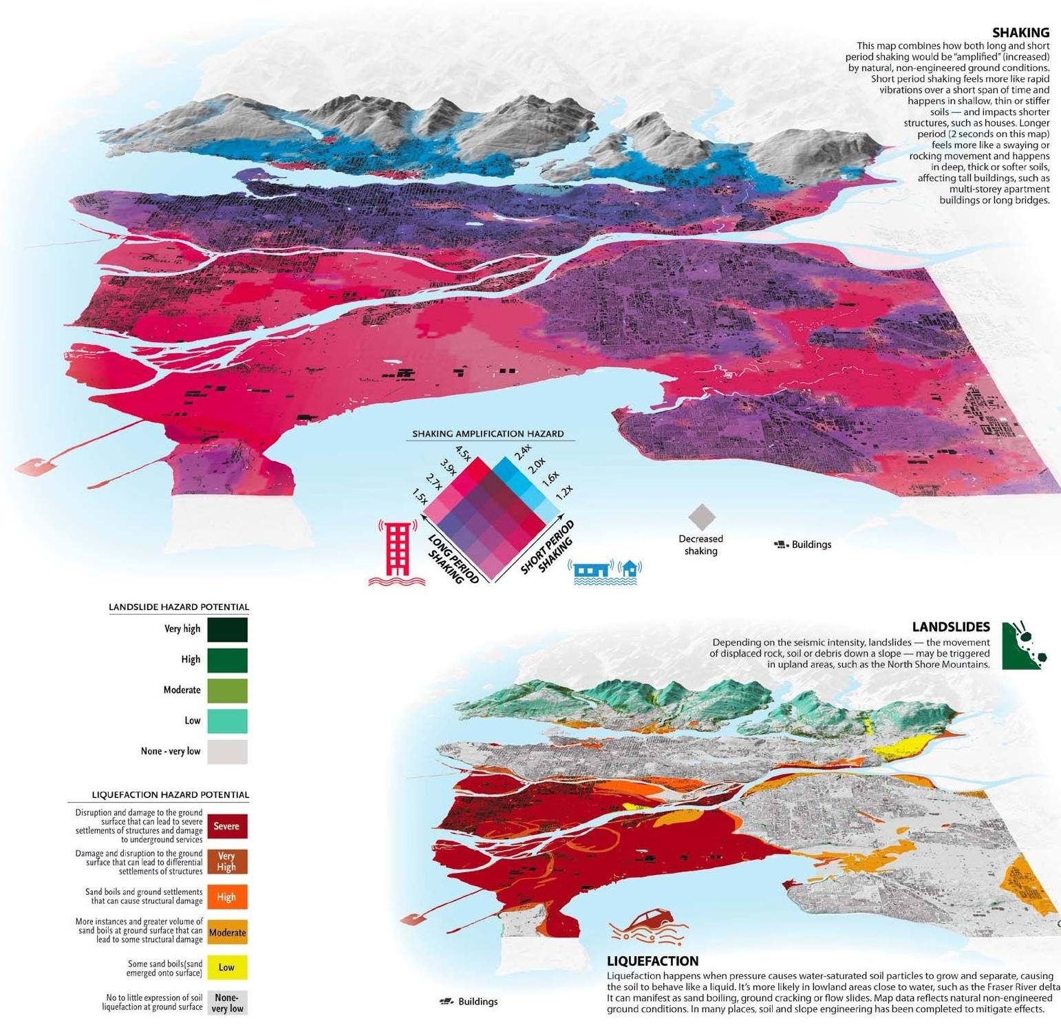
These field tests are part of the second phase of a 10-year study led by associate professor Sheri Molnar that is mapping how seismic hazards vary on a neighbourhood scale based on underlying ground conditions in Metro Vancouver. While pursuing postdoctoral work nearly a decade ago, Molnar was surprised to learn Metro Vancouver, one of Canada’s most seismically active regions, lacked a comprehensive seismic microzonation map.