YOU CAN’T SCRIPT ADVENTURE
Scribbles on a map and someone else’s GPX files can never substitute local knowledge. Unfortunately James McKnight didn’t have any of that and, as he discovered, he was soon in way over his head in some of the Pyrenees’ most remote countryside.
WORDS JAMES MCKNIGHT
PHOTOGRAPHY VICTOR LUCAS
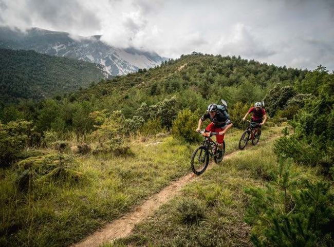
Photographer Victor Lucas and I had been talking about this trip for over a year since I first visited the remote village of Nocito (population 10), a luscious place set among alluring hills on the edge of the Pyrenees. I had been wooed by Nocito’s charm as a mysterious settlement in an improbable location quite a long way from nowhere at all really. We had both been intrigued by the idea of bikepacking, or whatever you want to call going for a long ride carrying everything you need. However, glamorous images of heroes making their way through immense landscapes had perhaps not told us the entire story as we would soon find out… Bikepacking ain’t easy.
Finally in Spain, we were joined by Ben Winder, a lastminute addition to the team, and beginning to wonder if we’d bitten off more than we could chew. At least for once we had done a great job in terms of coordinating kit and learning about the route – we wrongly thought.
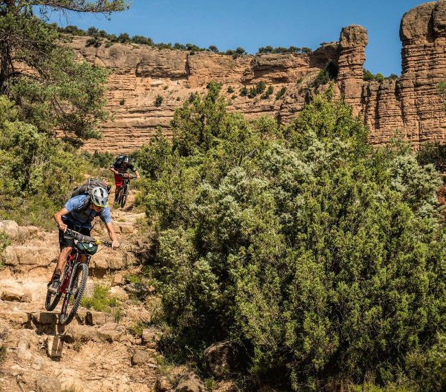
Whatever the case, any level of good organisation wasn’t going to be enough to save us from our greatest weakness – optimism. Our proposed ride would follow several GPS tracks found online, ducking in and out of the offbeat Sierra y Canones de Guara Natural Park, a magnificent area of time-eroded mountains and deep crags in the province of Huesca, Aragon. Having gauged the speed of whoever created the GPS file, we’d come here expecting a mostly gravel road and mellow singletrack ride and based our daily kilometres on that. What we didn’t know was the creator of that GPS file was some sort of rocky trail-craving, kilometre-crunching machine…
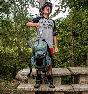
Who has room for the shuttlecock?
The boys were expecting to swat some very large flies.
Better get going.
The first day was already quite bluntly informative of our over-zealous route planning. Six hours after leaving the campsite in Nocito we were somehow just 15km from the start line – these ancient paths were not conducive to forward progress. We were also starving hungry, a side effect of going into a sparsely populated area expecting to find a burger stand.
The point where we stood, somewhere beyond the remains of Used (population: zero), served only rocks and hard places. It seemed our order was between the two.
To further add gravity to our situation, as we crawled at great lack of speed along an awful trail littered with fist-sized rocks and spiky bushes, an English-speaking Frenchman with a strong Liverpudlian accent (an irrelevant, but interesting detail) stopped us in our tracks. “Alright fellas?” We asked where one might find the campsite at Rodellar (population: 50). “Where? Jamais heard of it, man.” He’d just appeared from the direction we were heading. “But I can tell you the next section of trail is terrible! Shouldn’t you have set out earlier?”