Mapping
Mapping made easy
KDE MARBLE
Nick Peers reveals how to navigate the world using a variety of maps without leaving the comfort of your home PC.
OUR EXPERT
Nick Peers prides himself on his sense of direction but is not to be trusted when he announces he’s found a shortcut. Expect to double your journey time.
Yhink maps, and the obvious solution is to flip out your phone or web browser and head to T Google Maps. But that doesn’t sit well with our open source ethos, which is why we’re fans of OpenStreetMap (see feature LXF276). And what better way to interact with OpenStreetMap – and a host of other maps – than through your desktop with KDE Marble (https://marble.kde.org)?
Marble offers far more than just a simple way to view maps. Think of it more as a desktop globe with built-in extras, including optional encyclopaedia and weather reports, all powered by friendly engines from OpenStreetMap to Wikipedia. In fact, Marble can go beyond the confines of Earth to cover other planets and even dip into your imagination. It’s even capable of plotting routes from A to B (even Olympus Mons? – Ed), although this is perhaps its weakest part.
Finding your way to Marble
You’ll find Marble in all major distro package managers – sudo apt update && sudo apt install marble installs the version bundled with your Linux distro with the minimum of fuss. You can get the latest version through Snap ( sudo snap install marble ) or Flatpak (visit https://flathub.org/apps/org.kde.marble), but there’s very little difference between them, and in our experience only the Flatpak version worked correctly. For the purposes of this tutorial, though, we’re focusing on version 2.2.20, which ships with Ubuntu 22.04 LTS.
When you launch Marble, you’ll see the default map offers a variety of views of the planet, with a classic topographical view – Atlas – selected by default. You can use the controls on the right of the map to zoom in and out, plus move around the map, but it’s quicker to use your mouse: zoom using the wheel, then click and drag to move around. As you zoom into the Atlas, you’ll see it’s rather basic, and you can’t zoom in that far.
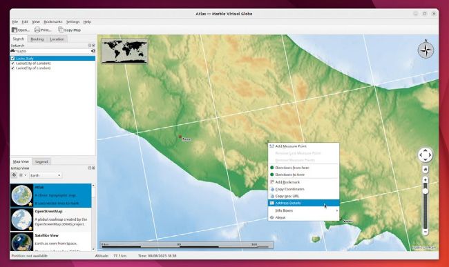
Marble’s default atlas view is rather sparse on detail, but does provide a good topographical overview of terrain.
GET MORE INSIGHTS
Marble’s map can display all kinds of useful information – by default you see a compass in one corner, a thumbnail of the world in the other and a scale at the bottom. These are known as Info Boxes, and you can toggle them on and off, plus add more via View > Info Boxes. One of the most useful is Elevation Profile, which works with Marble’s routing tools and will be of particular interest to cyclists.
Select View > Online Services and you unlock 10 more widgets. Roll your mouse over each one for a description. Two standouts are OSM Mapper Notes, which displays comments from users that are displayed as large red droppers, and Wikipedia, which downloads location-based Wiki articles and places them on the map for easy retrieval.
Another two worth considering are Post Codes, which displays postcodes as an overlay as you move around the map, and Weather, which displays current weather conditions from selected weather stations (so expect to have to zoom out of the map to see them). Click on the weather icon and choose the station’s name for a more detailed summary.
Choose Settings > Configure Marble Virtual Globe > Plugins and you can remove both Info Boxes and Online Services from their respective menus, but also look out for a configuration button next to individual plugins, which allows you to customise them further.