SOFTWARE DEFINED RADIO
Decode signals from weather satellites
Weather satellites transmit signals that you can receive and decode to generate images of the Earth. Mike Bedford shows you how.

Credit: https://noaa-apt.mbernardi.com.ar
OUR EXPERT
Mike Bedford is fascinated by receiving signals from weather satellites and processing the data to generate images.
QUICK TIP
Since the NOAA polar orbiting satellites orbit at only 850km and you can easily receive their radio signals, you might wonder if you can see the NOAA polar orbiting satellites by looking at the sky. According to the NOAA, they are considered naked eye objects but only just. In practice, therefore, you’re only going to see them in dark rural areas.
Satellite-based images of the Earth showing cloud cover have been a regular sight in TV weather broadcasts since the TIROS 1 satellite launched in 1960. Yet while the end result is familiar, the technology that brings us those images is much less well-appreciated. If you want to learn about the technology involved, though, it’s not too difficult to get a basic understanding.
However, you can gain some hands-on experience, as we demonstrate here, and a practical approach is often one of the best ways of learning. So, we’ll show you how to receive the radio signals transmitted by these satellites and how to decode that data to generate pictures. In addition, we’ll also investigate some ways of image processing to improve that image and perhaps introduce some false colour into the inherently monochrome images transmitted by the satellites.
NOAA satellites
Here we’re going to be looking at the so-called NOAA polar orbiting satellites – NOAA-15, NOAA-18 and NOAA-19 – that are operated by America’s National Oceanic and Atmospheric Administration. We’ve chosen these satellites because they orbit the Earth at an altitude of just 850km. Since they aren’t too far above our heads, their radio signals are quite strong and easy to receive.
If you’re wondering why the satellite numbers aren’t contiguous, all satellites from NOAA-6 have existed but most are no longer operational, including NOAA-16 and NOAA-17 even though they were launched after NOAA-15. However, NOAA-15 has been experiencing operational problems since 2019 so there are no guarantees that you’ll be able to receive and decode its transmissions, even though we had no difficulties.
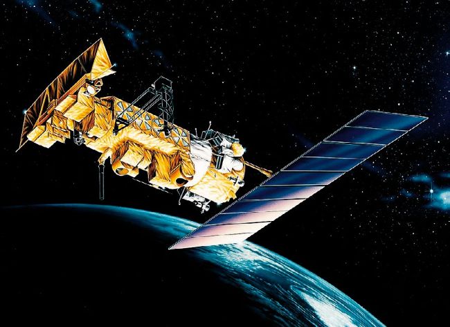
Launched in 1998, NOAA-15 is still mostly operational, despite it having had a design lifetime of just two years.
CREDIT: NASA
There’s also an NOAA-20, but this is the first of a new generation of polar orbiting satellites. It transmits on a much higher frequency which makes it significantly more difficult to receive. For that reason, decoding software probably won’t be too plentiful, although one offering is reportedly available at an alpha testing stage.
The laws of gravity dictate that any Earth satellite has a velocity and hence also an orbital period, which depends on its altitude. This means that the launch and fine-tuning of its altitude is critical to ensuring that it orbits the Earth in the time that was intended by its designers. Specifically, the closer a satellite is to the surface of the Earth, the faster it orbits.
Let’s take the example of a satellite at an altitude of 35,786km. It’ll orbit the Earth every 24 hours so, if it’s in an equatorial orbit, travelling in the same direction as the Earth’s rotation, it’ll appear to be stationary above a particular point on the planet. This is referred to as a geostationary orbit and there are geostationary weather satellites, for example NOAA’s GEOS-15, GEOS-16 and GEOS-17. Turning to our main theme of the polar orbiting NOAA satellites, their 850km altitude means that they orbit the Earth just over 14 times every 24 hours. As the name suggests, the orbits of these particular satellites take them over both the poles. However, most importantly, because the Earth is rotating below them, every orbit is shifted in such a way that it passes over a different swathe of the Earth’s surface compared to the previous orbit. This arrangement enables each satellite to obtain images from any point on the Earth’s surface twice each day: once during daylight and once at night.