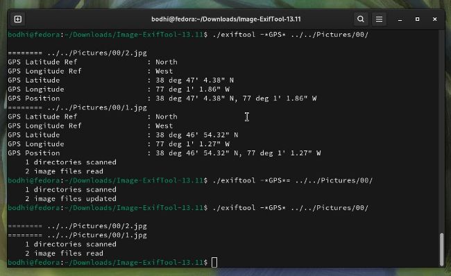
You can easily use ExifTool to strip all location-specific metadata from your holiday snaps before you share them online.
I f you are a shutterbug, ExifTool is a handy utility to have in your image-editing portfolio. This CLI tool comes in handy when you need to modify the metadata associated with an image. While you can do this with several graphical photo-editing apps as well, ExifTool makes it fairly simple to do this for multiple images in a fraction of the time.
ExifTool doesn’t need to be installed. You can simply download and extract the tool’s tarball and run it directly with the following: $ wget https://exiftool.org/Image-ExifTool-13.11.tar.gz $ gzip -dc Image-ExifTool-13.11.tar.gz | tar -xf -$ cd Image-ExifTool-13.11 $ ./exiftool <imagefilename>
When you point the tool to an image file, it prints all of its metadata. Usually, however, you are only interested in a few particular tags. For instance, if you wish to view the location-specific metadata for an image, you can pull up just its GPS data with exiftool -*GPS* holiday-pic.jpg .
This command displays all of the tags with the phrase GPS in their name, such as GPSLatitude, GPSLongitude, GPSPosition and others.